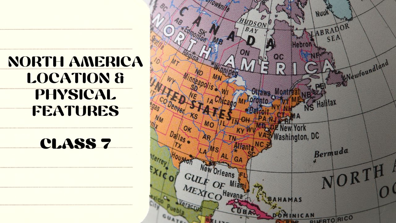
his page presents important North America Location and Physical Features ICSE Class 7 Questions and answers to support exam preparation. The chapter covers North America’s geographical location, major landforms, rivers, mountain ranges, and surrounding oceans. These solved Q&As simplify core concepts and help ICSE Class 7 students strengthen their understanding of the continent’s physical geography.
A. Tick the correct answers:
Which of the following countries is not in North America? Seychelles
Which of the following mountain ranges is not located in the Western Cordillera? Blue Ridge
What does the word Prairie mean? Grassland
Which of the following rivers drain into the Pacific Ocean? Fraser, Rio Grande
Which of the following lakes is not among the Great Lakes? Athabasca
B. Fill in the blanks:
The Isthmus of Panama joins North America with South America.
The capital of Cuba is Havana.
In between Lake Erie and Lake Ontario lies the Niagara Falls.
The Appalachian Highlands are located on the eastern side of North America.
Lake Chapala is located in Mexico.
C. Give reasons for the following:
The rivers that originate in the Canadian Shield flow into the Hudson Bay: The Canadian Shield has a general slope towards the Hudson Bay. Since rivers follow the natural gradient of the land, most rivers originating in this region flow northward into the Hudson Bay.
The Appalachian Highlands are also called the Eastern Highlands: The Appalachian Highlands are located on the eastern side of North America, extending from Canada to the United States. Their location gives them the name “Eastern Highlands.”
The Prairies are known as the “Granary of the World”: The Prairies have fertile soil and a favorable climate, making them ideal for growing wheat and other grains on a large scale. This has earned them the title “Granary of the World.”
The Western Cordillera is prone to earthquakes and volcanic activity: The Western Cordillera is part of the Pacific Ring of Fire, a tectonically active region with frequent earthquakes and volcanic eruptions due to the movement of the Pacific and North American plates.
The Great Lakes are important for trade and transportation: The Great Lakes provide a major inland waterway for trade and transportation, connecting cities in the United States and Canada. They are also linked to the Atlantic Ocean via the St. Lawrence River.
D. Answer the following questions:
What is the latitudinal and longitudinal extent of North America? Ans: North America lies entirely in the Northern Hemisphere. It extends roughly between 7°N and 83°N latitude. It also lies entirely in the Western Hemisphere, extending between 53°W and 180°W longitude.
Name the European nations that established settlements in North America. In what parts of the continent did they settle? Ans:
The French settled in the St. Lawrence River Valley.
The Dutch established trading settlements along the Hudson River.
The British settled around Chesapeake Bay and other areas between the Appalachians and the Atlantic Ocean.
The Spanish settled around the Gulf of Mexico.
In 1776, 13 British colonies along the Atlantic Seaboard won their independence and formed the United States of America.
Write about the location and extent of the Western Cordillera. Name four intermontane plateaus located here. Ans:
The Western Cordillera is an extensive mountain system located in the western part of North America.
These young fold mountains run from Alaska in the north to Panama in the south.
The Cordillera consists of roughly three parallel ranges, extending 6,500 km in length and 650 km to 1,600 km in width.
The height of these mountain ranges varies between 2,500 m and 4,000 m above sea level.
Intermontane Plateaus:
Alaska Plateau
Columbia Plateau
Great Basin
Colorado Plateau
Mention the three physical characteristics of the Canadian Shield. Name five minerals found in this shield. Ans: Characteristics of the Canadian Shield: a. The Canadian Shield is centered around Hudson Bay and covers the northern and northeastern parts of North America. b. It contains some of the oldest and hardest rocks in North America, with an average elevation of 600 meters above sea level. c. The general slope of the Shield is towards Hudson Bay, and it has many rounded hills, lakes, and swamps.
Five Minerals Found in the Canadian Shield:
Gold
Silver
Uranium
Nickel
Copper
Where is the Prairie located? What type of landform is found here? Ans:
The Prairies lie in the Central Lowlands, located between the Appalachian Mountains in the east and the Rocky Mountains in the west.
The southern extent of the Prairie is about 4,800 km, while the east-west width is about 2,000 km.
Landforms of the Prairie:
The eastern part is flat.
The western part rises to about 500 meters.
The northern part slopes towards the Arctic Ocean, while the southern part slopes towards the Gulf of Mexico and the Atlantic Ocean.
Name two rivers each that flow into the Arctic Ocean, Atlantic Ocean, and the Gulf of Mexico. Ans:
Arctic Ocean:Mackenzie, Nelson
Atlantic Ocean:St. Lawrence, Hudson
Gulf of Mexico:Mississippi, Missouri
Africa-Climate and Natural Vegetation
A. Tick the correct answers:
The Labrador Current and the Gulf Stream are responsible for fog formation near (Newfoundland/ Baffin Island).
The (Gulf Stream/ North Pacific Drift) influences the marine type of climate.
The Caribbean is mostly found in the (Tundra region/ Prairie).
The (Musk Ox/ American Bison) is not found in the temperate grasslands.
(Giant Redwood/ Maple) tree is not found in the taiga forest.
Severe droughts are experienced in the southwestern part of North America:
The southwestern part of North America falls in the rain shadow region of the Western Cordillera, which blocks moisture-laden winds.
The cold California Current reduces evaporation and rainfall in this area.
The region has an arid and semi-arid climate with high temperatures and little rainfall, leading to frequent droughts.
Tall grasses grow in the prairies:
The prairies receive moderate rainfall, which is enough to support grass growth but not sufficient for dense forests.
The region has fertile soil, which allows grasses to grow taller and denser.
Seasonal rains and warm summers create ideal conditions for grasslands.
D. Answer the following questions:
Explain the influence of ocean currents and prevailing winds on the climate of North America. Ans: Ocean Currents:
The warm Gulf Stream flows along the eastern coast of North America, increasing temperature and precipitation in the region.
The cold California Current along the western coast lowers temperature and reduces rainfall.
The cold Labrador Current creates a freezing climate along the eastern coast of North America and is responsible for fog formation near Newfoundland.
Prevailing Winds:
The westerlies influence northern North America, bringing heavy rainfall to the northwestern coast but keeping the northeastern coast relatively dry.
The trade winds influence southern North America, bringing rainfall to the southeastern coast but making the southwestern coast dry.
Name the different types of climate found in North America. Ans: The different types of climate found in North America are:
Tundra climate
Taiga climate
Cool temperate east coast climate
Cool temperate west coast climate
Cool temperate continental climate
Tropical climate
Mediterranean climate
Desert climate
Which part of North America experiences the Mediterranean climate? What are the characteristics of this climate? Ans:
The Mediterranean climate is found in a narrow belt along the southwestern coast, mainly in the state of California, USA.
Characteristics of the Mediterranean climate: a. Hot and dry summers, with mild and wet winters. b. This region receives most of its rainfall in winter due to westerlies. c. The summers are influenced by the subtropical high-pressure belt, leading to dry conditions. d. The climate supports Mediterranean vegetation, such as olive, citrus fruits, and evergreen shrubs.
Name the different types of natural vegetation found in North America. Ans: The different types of natural vegetation found in North America are:
Tundra vegetation
Taiga forests
Cool temperate forests
Warm temperate forests
Temperate grasslands (Prairies)
Tropical forests
Mediterranean forests
Desert vegetation
What is permafrost? Where is it found in North America? Ans:
Permafrost refers to permanently frozen subsoil, which remains frozen throughout the year.
It is found in the northern parts of North America, extending from Alaska to the Labrador Peninsula.
The Tundra region is covered with snow and ice for about eight months a year, preventing deep-rooted plants from growing.
Distinguish between cool temperate and warm temperate forests. Ans:
Warm Temperate Forests
Cool Temperate Forests
Found along the Gulf Coast of the USA, including Florida.
Found in Southeast Canada and Northeast USA.
Consists mostly of deciduous trees.
Consists of mixed forests (both coniferous and deciduous trees).
Trees found: Oak, Pine, Chestnut, Cypress, and Elm.
Trees found: Beech, Birch, Maple, Oak, and Chestnut.
North America-Resources
A. Tick the correct answers:
(Canada/ Jamaica) does not grow tobacco.
(Alaska/ Mexico) is the largest producer of silver in the world.
(Canada/ Nicaragua) is the largest producer of pulp and paper.
The (Red Indians/ Negroes) were brought as slaves to North America from Africa.
The long-distance, 4 or 6-lane roads of North America are called (Highways/ Freeways).
B. Fill in the blanks:
The forests of North America provide occupation to people in forestry and lumbering.
In North America, cattle are reared for milk and meat.
The most important coal-producing region in the USA is Pennsylvania.
The Spanish migrants have settled around the Gulf of Mexico, while the French migrants settled along the Saint Lawrence River.
The Panama Canal connects the Atlantic Ocean with the Pacific Ocean.
The continental shelf along the coasts of North America is wide and shallow, providing an ideal environment for fish.
The meeting of warm and cold ocean currents (e.g., Gulf Stream and Labrador Current) leads to abundant plankton growth, which attracts large fish populations.
The availability of modern fishing technology has further contributed to the growth of the fishing industry.
Cities have high population densities:
Cities provide better job opportunities in industries, business, and services.
They have modern infrastructure, including transportation, healthcare, and education.
Immigration from rural areas and other countries has increased urban populations.
Cities have well-developed commercial hubs that attract businesses and workers.
Short note on the forest resources of North America. Ans: The forests of North America provide valuable timber and a variety of other important forest products.
Wood from coniferous forests is mainly used to make pulp and paper.
Trees also provide timber for building materials and cellulose for rayon, resin, and turpentine.
The wood from spruce and pine trees is used to make newsprint.
The wood of oak and willow trees is used for furniture.
The sap of the maple tree is widely used to make sugar.
Hardwood from tropical forests is used to make railway sleepers.
The wood of mahogany and cedar is mainly used to make cigar boxes in Cuba.
Name the factors responsible for the development of agriculture in North America. Ans: The factors responsible for the growth of agriculture in North America are:
Large farm sizes (ranging from 2,000 to 20,000 hectares).
Mechanized farming with modern technology.
Monoculture farming, where only one crop is grown on a large scale.
Use of scientific techniques in farming.
Widespread use of chemical fertilizers and pesticides.
Low labor force but high per capita production.
Farms are privately owned, with no tenant system.
Where are the Corn Belt, Cotton Belt, and Tobacco Belt located? Ans:
The Corn Belt is found in the Mississippi Basin, where corn is the most widely cultivated cereal crop.
The Cotton Belt is located south of the prairies, in the southern part of the Mississippi Basin, where cotton is grown.
The Tobacco Belt is found northeast of the Cotton Belt, where tobacco is a major crop.
Name the minerals found in the Lake Superior region. Ans: The Lake Superior region produces large quantities of gold, nickel, platinum, copper, and silver.
Name the industries found in North America. Ans: The main industries found in North America are:
Flour milling
Wood pulp and paper
Newsprint
Textiles
Iron and steel
Automobiles
Engineering goods
Write a short note on the density of population in North America. Ans:
The total population of North America is about 550 million.
The average population density is 22 persons per square kilometer.
Western mountains, deserts, plains, and northern regions are sparsely populated.
The eastern coast and central lowlands have high population density.
Mexico City is the most populous city in North America.
Most people live in urban areas, as cities offer better employment and facilities.
Name the important waterways of North America. Which river connects the Great Lakes with the Atlantic Ocean? Ans:
Important waterways in North America:
Saint Lawrence River
Great Lakes waterway system
Mississippi River
The Saint Lawrence River connects the Great Lakes with the Atlantic Ocean.
Lumberkacks of Canada
A. Tick the correct answers:
(Canada/ Jamaica) does not grow tobacco.
(Alaska/ Mexico) is the largest producer of silver in the world.
(Canada/ Nicaragua) is the largest producer of pulp and paper.
The (Red Indians/ Negroes) were brought as slaves to North America from Africa.
The long-distance, 4- or 6-lane roads of North America are called (Highways/ Freeways).
B. Fill in the blanks:
The forests of North America provide occupation to people in forestry and lumbering.
In North America, cattle are reared for milk and meat.
The most important coal-producing region in the USA is Pennsylvania.
The Spanish migrants have settled around the Gulf of Mexico, while the French migrants settled along the Saint Lawrence River.
The Panama Canal connects the Atlantic Ocean with the Pacific Ocean.
The continental shelf along the coasts of North America is wide and shallow, providing an ideal environment for fish.
The meeting of warm and cold ocean currents (e.g., Gulf Stream and Labrador Current) leads to abundant plankton growth, which attracts large fish populations.
The availability of modern fishing technology has further contributed to the growth of the fishing industry.
Cities have high population densities:
Cities provide better job opportunities in industries, business, and services.
They have modern infrastructure, including transportation, healthcare, and education.
Immigration from rural areas and other countries has increased urban populations.
Cities have well-developed commercial hubs that attract businesses and workers.
D. Answer the following questions:
Short note on the forest resources of North America. Ans: The forests of North America provide valuable timber and a variety of other important forest products.
Wood from coniferous forests is mainly used to make pulp and paper.
Trees also provide timber for building materials and cellulose for rayon, resin, and turpentine.
The wood from spruce and pine trees is used to make newsprint.
The wood of oak and willow trees is used for furniture.
The sap of the maple tree is widely used to make sugar.
Hardwood from tropical forests is used to make railway sleepers.
The wood of mahogany and cedar is mainly used to make cigar boxes in Cuba.
Name the factors responsible for the development of agriculture in North America. Ans: The factors responsible for the growth of agriculture in North America are:
Large farm sizes (ranging from 2,000 to 20,000 hectares).
Mechanized farming with modern technology.
Monoculture farming, where only one crop is grown on a large scale.
Use of scientific techniques in farming.
Widespread use of chemical fertilizers and pesticides.
Low labor force but high per capita production.
Farms are privately owned, with no tenant system.
Where are the Corn Belt, Cotton Belt, and Tobacco Belt located? Ans:
The Corn Belt is found in the Mississippi Basin, where corn is the most widely cultivated cereal crop.
The Cotton Belt is located south of the prairies, in the southern part of the Mississippi Basin, where cotton is grown.
The Tobacco Belt is found northeast of the Cotton Belt, where tobacco is a major crop.
Name the minerals found in the Lake Superior region. Ans: The Lake Superior region produces large quantities of gold, nickel, platinum, copper, and silver.
Name the industries found in North America. Ans: The main industries found in North America are:
Flour milling
Wood pulp and paper
Newsprint
Textiles
Iron and steel
Automobiles
Engineering goods
Write a short note on the density of population in North America. Ans:
The total population of North America is about 550 million.
The average population density is 22 persons per square kilometer.
Western mountains, deserts, plains, and northern regions are sparsely populated.
The eastern coast and central lowlands have high population density.
Mexico City is the most populous city in North America.
Most people live in urban areas, as cities offer better employment and facilities.
Name the important waterways of North America. Which river connects the Great Lakes with the Atlantic Ocean? Ans:
Important waterways in North America:
Saint Lawrence River
Great Lakes waterway system
Mississippi River
The Saint Lawrence River connects the Great Lakes with the Atlantic Ocean.
What do you know about the location of Detroit? Ans: Detroit is located in the state of Michigan, USA. It lies on the Detroit River, which connects Lake Erie and Lake St. Clair. The city is situated on the border with Canada, opposite Windsor, Ontario. Its strategic location near the Great Lakes made it an important center for trade and industry.
How did the Industrial Revolution change Detroit? Ans: The Industrial Revolution transformed Detroit into a major manufacturing hub, particularly in automobile production.
The introduction of mass production by Henry Ford revolutionized the automobile industry.
Detroit became known as the “Motor City”, attracting workers from different regions.
The automobile industry led to rapid urbanization, with many factories, businesses, and infrastructure developments.
The growth of the steel, glass, and rubber industries supported automobile manufacturing.
The transportation network expanded, including railways and ports for exporting cars.
Enumerate the factors responsible for the rapid growth of the automobile industry in Detroit. Ans:
Abundance of natural resources such as iron, coal, and rubber.
Innovations in mass production, including the assembly line introduced by Henry Ford.
Skilled labor force from European and African American migration.
Proximity to the Great Lakes for easy transportation of raw materials.
Investment from entrepreneurs and banks in the auto sector.
Growing demand for automobiles due to rising incomes in the USA.
What are the three main automobile manufacturing plants in Detroit? Ans: The three main automobile manufacturers in Detroit, known as the “Big Three”, are:
Ford Motor Company
General Motors (GM)
Stellantis (formerly Chrysler)
Name four industries that emerged in the aftermath of the recession in the American automobile industry. Ans: After the decline of the automobile industry, the following industries grew in Detroit:
Technology sector (IT companies and startups).
Healthcare industry (hospitals, research centers, and medical services).
Education sector (universities and research institutions).
Entertainment and tourism (music industry, museums, and casinos).